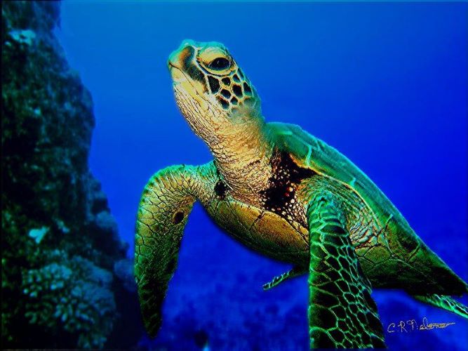
Innovative Mapping of Seagrass Meadows Using Green Turtles

grass meadows are essential marine ecosystems that play a crucial role in maintaining biodiversity, storing carbon, and stabilizing seabeds. However, mapping these underwater habitats has proven challenging due to technological limitations. A recent study published in the Proceedings of the Royal Society B reveals a groundbreaking method for mapping seagrass meadows more accurately. Researchers from the King Abdullah University of Science and Technology (KAUST) in Saudi Arabia used satellite-tagged green turtles to enhance the mapping process. This innovative approach was tested in the Red Sea, an area known for its limited seagrass data.
Tracking Green Turtles to Locate Seagrass
The study involved tagging 53 green turtles (Chelonia mydas) along the Saudi Arabian coast of the Red Sea. Led by Dr. Hugo Mann, a marine ecologist at KAUST, the researchers equipped the turtles with satellite transmitters after their nesting cycles. This timing was crucial to avoid disrupting the turtles during their nesting period.
The satellite devices transmitted location data whenever the turtles surfaced for air. This data revealed consistent movement patterns, allowing researchers to identify specific sites where the turtles frequently visited. These areas were confirmed to be seagrass meadows, leading to the discovery of 34 previously unrecorded patches. Validation efforts showed that seagrass was present in all locations identified by the turtles. In contrast, only 40% of the sites flagged by the Allen Coral Atlas, a remote sensing tool, were verified. Carlos Duarte, a senior marine ecologist at KAUST, emphasized the limitations of existing mapping techniques for underwater habitats, highlighting the need for more effective methods.
Environmental and Conservation Implications
Seagrass meadows are vital for carbon sequestration, with the study estimating that they can store up to 4 teragrams of carbon. Dr. Mann stressed the importance of accurately identifying these ecosystems to enhance conservation strategies. Human activities increasingly threaten seagrass, making precise mapping essential for their protection.
Dr. Jennifer Dijkstra, a marine ecologist at the University of New Hampshire, noted that animal tracking could significantly improve artificial intelligence-based mapping techniques. This advancement could offer a potential global solution for resource-constrained regions where traditional mapping methods fall short. The researchers hope that this innovative method will facilitate large-scale surveys, ultimately aiding conservation efforts for both seagrass habitats and the green turtles that rely on them.
Future Directions for Seagrass Mapping
The findings from this study open new avenues for marine research and conservation. By leveraging the natural behaviors of green turtles, scientists can gain valuable insights into the distribution of seagrass meadows. This approach not only enhances the accuracy of mapping but also provides a cost-effective alternative to traditional remote sensing methods.
As the world faces increasing environmental challenges, the need for effective conservation strategies becomes more pressing. The integration of animal tracking with advanced mapping technologies could revolutionize how we monitor and protect vital marine ecosystems. Researchers are optimistic that this method will lead to better conservation outcomes for seagrass meadows and the diverse marine life they support.
Observer Voice is the one stop site for National, International news, Sports, Editor’s Choice, Art/culture contents, Quotes and much more. We also cover historical contents. Historical contents includes World History, Indian History, and what happened today. The website also covers Entertainment across the India and World.

